The Tail of the Dragon

Chinese Odyssey 81

So different today

many fine roads and schools

and ferries to Hainan

and great swimming pools

The beaches of Sanya

crowned Miss Universe

The old revolution

seemed now in reverse.

OLYMPUS DIGITAL CAMERA

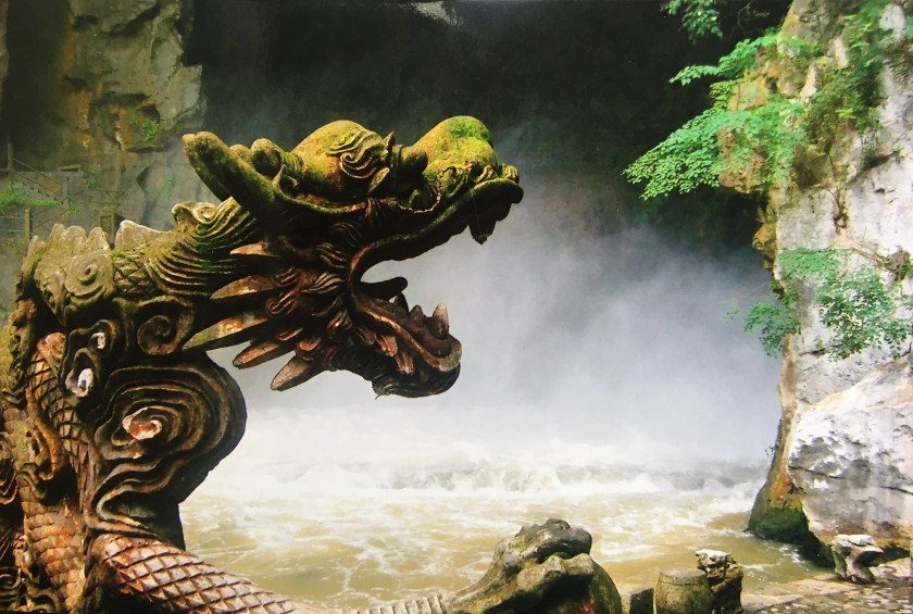
Hainan Dao is the smallest Chinese province and is an island only slightly smaller than Taiwan. Shaped like a fig, it sits in the South China Sea about 25 miles off the tamarind shaped Leizhou Peninsula (雷州半岛 Léizhōu Bàndǎo) off the southern tip of the Guangxi Zhuang Autonomous Region. 200 miles to the east of Hainan, across the Gulf of Tonkin lies Vietnam. Travel north and east along the China coast for 330 miles and you’ll arrive in Hong Kong. Although, China sometimes refers to Hainan Island as the “Hawaii of China”, it’s not quite there yet. It is about the same size as all of the Hawaiian islands combined, has beautiful white sand beaches and crystal clear waters and you can swim there all year round – but the infrastructure has a ways to go.

When we arrived at our 4 star hotel in Sanya in the early 2000’s, I was surprised to see a massive number of ‘Europeans’ everywhere. It didn’t take me long to realize that these ‘Europeans’ were really Russians. Signs in Russia were everywhere. There was Russian TV at the hotel. And I was addressed in Russian by vendors on the street. It turns out that huge numbers of Russians come to Hainan as much for the beaches and tropical sun, as for the medical tourism with Traditional Chinese Medicine being very popular (especially acupuncture, moxibustion, and cupping.)

Hainan first became a part of China in 110 BCE during the reign of Han Wu Di (漢武帝Hàn Wǔ Dì) in the Han Dynasty when a military garrison was set up there. The original inhabitants of the Island were the Li minority (黎族 Lízú) aka Hlai people, who were not happy about the invasion of their island by the Han Chinese and held onto control of the island well into the Tang Dyasty (618-907 CE.) Up to that time, Hainan Island was also a place where political and intellectual enemies of the ruling Chinese elite were banished. The Han Chinese who lived on Hainan were confined to the coastal areas. During the Song Dynasty (960−1279 CE), Hainan Island became a part of Guangxi Province and large numbers of Han Chinese moved there. Later on, during the Ming Dynasty (1368 to 1644 CE), Hainan was put under the administration of Guangdong Province.

Some of the early lures of Hainan Island were its northern bed of pearls as well as the precious gems and scented woods from the region’s rich interior. Two major groups of Li people occupied the island. The Sheng Li (生黎) were also known as the savage Li or the wild Li where the Shu Li (熟黎) were considered to be the tame or the civilized Li. The Shu Li accepted the supremacy of the ruling Chinese and intermarried with the Han, whereas the Sheng Li continued to rebel and separate themselves from the invading Han. Like Taiwan, Hainan Island was also a haven for pirates and buccaneers and was a haven for opium smugglers and merchants to ply their trade.  As regards legitimate trade, timber became a lucrative item, especially in the Five Finger Mountain region. Hakka traders dealt in Xin Hua Li (a type of scented rosewood), Sandal Wood, and Nan Mu, a precious wood unique to this region used for boat building, architectural woodwork, and furniture. Towards the end of the Qing Dynasty (1644-1911 CE), the British Navy put an end to much of the piracy in the area and foreign religious groups established churches, hospitals, schools, and orphanages.

Hainan Dao remained underdeveloped until well into the 20th century. It was not until Liberation in 1952 that a road was finally built intersecting the mountainous central part of the island. There is a legend from the area called Five Finger Mountain (五指山Wǔzhǐshān). The story is that a man and his wife met a stranger on the road one day. After walking and talking with the man, the man presented them with a magic knife. The knife, he claimed, would make them rich . . . and it did. When an evil demon found out, however, he decided to rob and kill the couple so he could have the knife for himself. The couple learned of the plot and told their five sons who came to their rescue. Unfortunately, the sons were unsuccessful and all five sons were killed and the devil ended up with the knife. When five immortals heard the story, they went after the devil, slew him, and buried the sons in five parallel mounds. The mounds grew into hills and the hills became the Five Finger Mountains. Other stories claim that the five fingers are the fossilized fingers of a dead Li minority Chief and still another story dedicates the five mountain peaks to five Li gods.

Two events occurred in the 2000’s which focused the eyes of the world – many for the first time – on this beautiful island.

The first was the mid-air collision of a U.S. Navy spy plane with an interceptor fighter from the PRC in April, 2001. According to the Chinese People’s Daily, two Chinese F-8 fighter pilots were following a larger American plane flying near the coast of China, when suddenly the larger plane veered, striking one of the Chinese planes. The pilot of the Chinese fighter was killed in the incident and the American pilot of the EP-3 and his 24 man crew were forced to “violate Chinese air space.” US officials claimed that the US plane was flying over international waters and that the Chinese planes swooped in twice before “clipping the leftmost propeller on the third pass.” Even though permission to land was denied by the Chinese authorities, the American aircraft was disabled and was forced to make an emergency landing on Hainan Island where they were detained and interrogated by Chinese authorities for 10 days. To free the American crew, a “Letter of two sorries” was issued which was, according to US authorities “not a letter of apology” since the US had nothing to apologize for.

Mao Zedong had banned all beauty pageants in China. He called them “bourgeois nonsense” and said that participants were “lacking in self-respect.” In the early 1980’s, there were calls to “allow women to be women.” (Dr. Louise Edwards, director of the Modern China Studies program at the University of Hong Kong). Edwards went on to say, “The contemporary idea of womanhood seems to be linked to the ‘right to be beautiful and to beautify’ in China.” Actually one of the first acknowledged beauty pageants in the PRC was the Goat City Youth Beauty Competition which happened in 1985 in Guangzhou. Even though, looks only accounted for 15% of the final decision (the other 85% relied on a knowledge of politics, literature, economics, chemistry, temperament, and Putonghua proficiency), there was still plenty of controversy. Wasn’t this bourgeois liberalism? In 1993, Beijing University women rejected beauty pageants because they “objectified women” and in 1994, the China Federation of Women declared that beauty pageants were “products of a male-dominated society.” It wasn’t until 2003 that the Chinese Communist Party officially lifted the ban on beauty pageants. This was just in time for the resort city of Sanya (三亚市 Sānyàshì), on southern tip of Hainan Island, to host the Miss World contest. One year later, a transgender model by the name of Chen Lili applied to the compete in the Chinese Miss Universe contest and was initially accepted, but that was overturned before the actual contest. According to the Shanghai Morning Post, Miss Li “seemed to outshine all the beauty queens onstage.”

Hanoi to Hainan – Haves and Have Nots

Chinese Odyssey 80

 From Xingyi to Nanning

and west to Hanoi,

a Friendship Pass opened

bringing sorrow and joy.

In the midst of the war,

a banana peel

discarded by Gonggong

became one family’s meal.

https://upload.wikimedia.org/wikipedia/commons/1/1d/Banana_peel.jpg

My father-in-law came from a family of traders and merchants. China was a scary place to live in the 1930’s and 40’s. By December of 1938, much of the province of Guangdong had been occupied by Japanese forces. All Chinese males between the ages of 15 and 60 were suspected by the Japanese to be enemies or “enemies pretending to be local people.” Survival in southern China meant a lot of out of the box thinking and creative problem solving.

Gonggong left his home village in the Nanhai district of Guangdong to seek his fortune and help support his family by traveling south and west eventually ending up in Vietnam. Like his forefathers who had made their ways to San Francisco and then south to El Salvador 100 years earlier, Gonggong was a keen observer and was able to connect dots between what was available in certain areas and what was sought after in others. He saw possible business opportunities opening up in French controlled Vietnam, so he sought out distant relatives in Hanoi. There, he learned the lay of the land and was able to consider his options. Sometimes he would take the southern route, staying on the coast to Beihai – even taking the slow boat to Hainan Dao.  I have no idea how many times Gonggong crossed the 500 odd miles between Hanoi and Jiujiang, but I do know that there were enough trips for him to develop a familiarity with the region. From Hanoi north and east to Nanning before traveling the remaining 350 miles north and east to Jiujiang.

There was the 530 mile narrow-gage (1,000 mm – 3 ft 3 3⁄8 in) railway line built by the French between Hanoi and Nanning (Yunnan–Haiphong railway (滇越铁路 Diānyuè Tiělù) that was completed in 1910. Goods were transported on that line to both the KMT and others in China in need of European goods in the early days of the war, but once Nanning was taken and the Japanese occupied Vietnam, this line too was severed (for the allies), making “the Hump” air route the only way of getting supplies into China.

During the Han Dynasty, Emperor Han Wu Di (漢武帝 Hàn Wǔ Dì) conquered Vietnam (then known as Nan Yue 南越 Nányuè) and for 1,000 years, Vietnam was effectively a part of China. Many Chinese migrated there, drawn by the rich farmland and fishing of the Red River Delta. Scholars and government officials also alighted and set up a Chinese centralized state. Like Korea and Japan, Viet Nam adopted the Chinese writing system – until they recognized it was inadequate for their own linguistic needs nearly 1,000 years later. Confucianism also seemed to be a good fit for the Vietnamese as did Buddhism and Daoism.

Barely two hundred years into Chinese occupation, there was a famous rebellion started by two sisters by the surname of Tru’ung. Tru’ung Trac and Tru-ung Nhi came from a military family where they learned the arts of war. After Tru’ung Trac’s husband was killed, and Tru’ung Trac raped by the Chinese for resisting Chinese rule, Tru’ung Nhi convinced Tru’ung Trac to avenge their treatment and liberate Vietnam from the Chinese.  In 43 CE, the Tru’ung sisters led an independence revolt against the Chinese government which nearly succeeded, but after three years of fierce fighting, their revolt was ultimately crushed by the Chinese forces and the Tru’ung sisters drowned themselves to avoid capture. To this day, the Tru’ung sisters are national heroes in Vietnam. Chinese Premier Zhou En Lai visited a temple dedicated to the Tru’ung sisters as a show of respect during his first state visit to Viet Nam in 1956.

Towards the end of the Tang  Dynasty in the 10th century CE, however, the Vietnamese took advantage of the weakened Chinese government and upon prevailing in the Battle of Bach Dang River declared Vietnam free of the Chinese yolk, and finally secured independence for Vietnam which they called Annam.

The Friendship Pass 友誼關 Yǒuyì Guān; older name Ải Nam Quan (隘南關) was actually first established between Viet Nam and China during the Ming Dynasty in the 17th century. Then, it was called South Suppressing Pass 鎮南關 Zhèn Nán Guān,  and the pass itself actually served as the border between Viet Nam and China. This pass was later used by China and Vietnam during the early 1970’s to help the Vietnamese fight “American Aggression” in Vietnam. During that period, the Friendship Pass was anything but friendly. All along the pass were land mines, bamboo spikes, and barbed wire meant to prevent disruptions to the flow of goods.

When the initial clashes between China and Vietnam began in 1977, the Vietnamese government put pressure on its ethnic Chinese population and many of them fled north across the border. In 1979 400,000 PLA troops suddenly appeared on that same border to teach the Vietnamese a lesson for their assistance in bringing down the Khmer Rouge regime in Cambodia, who had been a close ally of the PRC. That was the last “border war” between the two countries. Vietnam and China began patching things up in the 1990’s as they worked together for common economic interests. Today, there remains a love-hate relationship between Vietnam and China, not unlike the scars the still exist in many families as the results of unresolved family feuds.

The one story I remember Gonggong telling about his traveling over Friendship Pass was when he felt hungry while walking along the road near present day Lang Son. He reached into his travel bag and pulled out a banana. As soon as he did, he noticed a small group of people following him. As he walked, the number grew. When he finally finished his snack, he tossed his banana peel into the road. Before it even hit the ground it was snatched up and torn apart by people desperate for anything to eat. Such was southern China in the early 1940’s.

Guizhou Cornucopia

Chinese Odyssey 79

Yet the wonders of Guizhou

made up for them all,

the Dong town of Zhaoxing,

Huangguoshu waterfall.

In the gorges near Xingyi,

we kayaked white water.

Arriving in Guangxi,

heard Liu San Jie’s daughter.

Huangguoshu Waterfall 2

From the Dong Village of Zhaoxing in the far south-eastern corner of Guizhou, we travelled west to  Kaili. There, they have a fun Sunday market where Dong and Miao people ply their crafts, art, and household wares. Thirty years ago wooden buckets could be picked up at any rural  community in southern China. I remember friends riding bicycles through Guangdong and buying these buckets off farmers for a few pennies. I’m sure farmers were dismayed by anyone wanting to buy their night soil buckets, but at that time, the farmers could turn around and buy a couple of new buckets for those same pennies. Today, shop keepers laugh at me when I ask if they sell “木桶 mù tǒng.” Why would anyone want a wooden bucket, when plastic buckets are so much lighter and easier to take care of? A few years ago, I was still able to find those wooden buckets in the Kaili Sunday market.

From Kaili to Guiyang is only about one-half hour by high speed train or a couple of hours by car. Guiyang (贵阳, Guìyáng) is the capital of Guizhou and is mostly unpretentious. That said, Guiyang is making a name for itself in the area of “big data.”  In this city of 4.5 million people, there are over 20,000 surveillance cameras aimed at the people of Guiyang. Flashback to Tom Cruise in the futuristic Minority Report. The future is here. The claim is that marketing analysis can be obtained real time by using the appropriate tools at a grand scale. Big data is not as much about the amount of data gathered, but rather how that data is organized to discover patterns and trends related to human behavior. And China is sitting on big data’s cusp. Part of China’s advantage has to do with China’s 730 million internet users. Guizhou got the nod of storing big data for companies like Tencent Holdings Ltd. (腾讯 Téngxùn) largely because  of its isolation and its insulation.

Continuing southwest about 100 miles, we arrived in Anshun (安顺 Ānshùn) and from there it was another 25 miles south to Huangguoshu Waterfall(黄果树瀑布 Huángguǒshù Pùbù)the largest waterfall in China. It was late June or early July and it had been raining a lot so the falls were at their fullest and they were really impressive. We broke out our rain gear and thoroughly enjoyed splashing our way through natural shower geysers firing at us from all directions. I remember walking under the water curtain into a cave (水帘洞) reminiscent of the one where the monkey king was born. Other waterfalls seem to converge from several directions into what looked like a massive earthenware sink called the Rhinoceros Pool (犀牛潭 Xīniú Tán) where I imagined a giant stooping down to do his morning ablutions. Still other waterfalls seemed more like strands of vermicelli or glassy Thai bean noodles hanging over a ledge in the distance. For an hour or more, we wandered through this natural water wonderland. When we came out near where we began, we were tired, and soaked, and smiling.

Maling Gorge (马岭河峡谷) near Xingyi (兴义) has been called the “birthplace of whitewater kayaking in China.” I wish I could say that we actually got to test the waters there ourselves, but alas, this was something we had not planned for and our time was too short. Still, we got to look down on the white water from the concrete arch Maling Gorge Arch Bridge, the first high bridge over the gorge. From our vantage point at the scenic lookout next to the bridge we could see at least a dozen waterfalls tumbling more than 100 meters down sheer cliffs into the roiling waters below. When our host asked us if we’d like to go down to the water, we thought she was kidding. We found hiking paths and steps that led us down about 30 meters, but the big surprise was a 70 meter elevator which took us the rest of the way down (and back up – of course.) At the bottom of the gorge there were foot bridges that allowed us to feel the river up close and personal. In 1998, China’s first whitewater kayaking competition was held there and since the 2008 Beijing Olympics, Maling Gorge has been the “National Training Base of Whitewater Kayaking.”

The story of Liu San Jie (刘三姐) is a popular story in China. Liu is a family name. The term “San Jie” means the “third oldest sister.” I mentioned in an earlier CO story that Chinese are commonly called by their rank in the family.  I think of the girls in one family of close friends who, to this day, I only know as Da Jie (big sister), Er Jie (second oldest sister), and San Mei (third youngest  sister).

Liu San Jie belonged to the Zhuang Minority (壮族 Zhuàngzú) and lived in the Guangxi Autonomous Region due south of Guizhou. The story started with a haunting song being sung by a female voice coming from a boat going through what looked like the karst hills around Guilin. The voice itself was not appealing to my western trained ear, but I kept listening as the picture panned into an old man and a handsome young man fishing from a small covered wooden boat where they, too, were mesmerized by the voice. White egrets and small nesting birds shared the screen with seven men with ropes around their bodies pulling a boat laden with merchandise up the river. Suddenly in a distance, Liu San Jie appears and we see actress Huang Wanqiu (黃婉秋) on a small boat made of tree branches, still covered with leaves, singing as she steers her way down the river with nothing but a bamboo pole. The two men decide to check her out so they pole their way over to her small skiff. The old man asks who she is, and Liu San Jie responds to all of his questions in song. Suddenly the young man bursts forward and says, “I know who you are. You are Liu San Jie!” They invite her on board and she accepts their invitation. The old man bursts into song, and the young man then dives into the water and catches a fish and then bursts into song himself. Liu San Jie is renowned in the area for her beautiful voice, her intelligence, and her courage. She had been orphaned at a young age and had been raised by her elder brother. Singing was a natural way for the Zhuang people to communicate. Liu San Jie sang songs about freedom and justice and about the way that the peasants were abused by the wealthy landowners. The laobaixing 老百姓 (common people) loved Liu San Jie, but the upper crust did not. Early in the movie, Liu San Jie got into a singing duel with one of the ruling elite and he had a heart attack and died after hearing the harsh accusations that Liu San Jie made about him and his family. The man’s family accused Liu San Jie of killing the man and arranged for her to be arrested. There are many incidents during the story where Liu San Jie stands up against tyrants like the infamous Mo Huai Ren. When the young man she befriends early on in the movie, defeats Mo Huai Ren’s lacky in a fist fight, Mo Huai Ren informs them that he owns everything in the area and that Liu San Jie and her friends would no longer be able to fish or hunt there. Liu San Jie challenges Mo Huai Ren to a singing duel and Mo accepts. Mo then hires three scholars who know “all the songs in the world” as his backup. Like freestyle battles between rappers, Liu and Mo’s songs go one after one another until Mo finally challenges Liu with the lines: “Tell now now, young lady, without pause: How many nails are there on our boat? How much do those mountains over there weigh? AND How many grains are there in a basket of oats?” To which, Liu San Jie answers without hesitation. Liu then quietly disappears from the scene with her lover, Li Xiao Niu.

In 2004, acclaimed director Zhang Yi Mou decided to stage Liu San Jie as yet another grand spectacular on the Li River in Yangshuo near Guilin. As with the Tea Horse Road extravaganza in Lijiang, this show involves approximately 600 performers who have been hired mostly from the local Zhuang community. They included fishermen, merchants, farmers, and young people. The 70 minutes show portrays actors on bamboo rafts performing on the actual Li River. “San Jie Liu Impressions” claims to be performed on the world’s largest natural stage. If you don’t understand Putonghua (Mandarin), becoming familiar with the story beforehand really helps get the most out of the experience. Maybe you will be able to answer: How many nails are there on our boat? How much do those mountains over there weigh? AND How many grains are there in a basket of oats?”


Guizhou – Poverty, politics, and pulchritude

Chinese Odyssey 78

The province of Guizhou

was poor and remote.

It’s said there were three things

they all lived without;

no three feet of flatland,

three days without rain,

three pieces of silver

were in their domain.

IMG_1392

Xi Jinping, China’s Premier, has been getting a lot of bad press these days, especially in the USA. Most recently due to the Hong Kong national security legislation, but that runs neck-to-neck with the coronavirus. Before that it was unfair trade practices, cyberespionage, the treatment Uyghurs in Xinjiang, and a host of other issues. What we don’t hear about very often, however, are some of Xi’s positive initiatives.

In October 2015, Xi vowed to eradicate poverty among the remaining 70 million poor Chinese people by the year 2020. Actually, the poverty eradication initiative started in 1984 when Deng Xiaoping said in a meeting with foreign guests:  “Socialism must eradicate poverty, and poverty is not socialism.” Since the year 2000, 600 million poor people had already been lifted out of poverty. Xi relied on his own experience growing up in a small impoverished agricultural community in the north-western part of Shaanxi province in the 1950’s and 60’s. This year, Xi has reiterated his solemn pledge during the March 2020 18th National Congress of the CCP, that despite Covid-19, this goal shall be met.

Even though, the name Guizhou, could be translated as “rich land”, for most of its history, Guizhou has been one of the poorer provinces of China largely due to topography and isolation. Guizhou sits on an old eroding plateau called the Yunnan Guizhou (aka Yun Gui) Plateau. It’s steep slopes, poor drainage, and red and yellow soil  make it challenging for farming. Only about 3% of Guizhou’s land is suitable for any type other than terrace farming and terrace farming requires large numbers of people working for little pay. Imagine not a hill, not a mountain, but a range of mountains sculpted by hand into steps of various sizes and shapes that all need to be maintained by an intricate system of irrigation controlled by massive numbers of men, women, and children using the most basic of farming tools.

Topography also made trade difficult since there were very few roads and no navigable rivers in Guizhou. Guizhou’s does have natural wealth, however, in terms of forests and plant and animal diversity, it is a treasure land to practitioners of Chinese medicine.

To address Guizhou’s poverty, there have been major initiatives throughout the province. New crops have been introduced that are more nutritious and have higher yields, both in terms of production and health benefits. Over 4,000 miles of new roads, highways, and modern suspension bridges have been built reaching some of the more isolated areas in the province. A well known idiom in China is 要想富先修路 yāo xiǎng fù xiān xiū lù which translates to, “If you want to become prosperous, you must first build roads.” In 1978, there were 18 million people living in poverty in Guizhou. 40 years later, in 2018, that number had been reduced to 1.5 million.

In December of 1934, after trudging 320 miles from Ruijin, Jiangxi, the 34th Division of the Red Army was nearly destroyed by Nationalist Troops at the Battle of the Xiang River (血战湘江) in Guangxi province. By the end of that battle only about 30,000 of the original 130,000 Red Army troops remained and things were looking bleak. With their strong reduction in numbers, they knew they would have to jettison much of their equipment, like x-ray machines,  printing presses, and heavy artillery, so they dumped it into the Xiang River and carried on. Mao persuaded Zhu De, Lin Biao, Zhang Wentian aka Lo Fu, and others that they should change course and meet up in Zunyi in Guizhou instead of south-eastern Sichuan. By the time they reached Zunyi in Guizhou in early January, 1935, it was clear that tactics and leadership needed to change. Otto Braun, the German comintern commander of the 1st army alongside Zhou En Lai and Bo Gu aka Qin Bangxian were poised to step aside. By the end of the Zunyi Conference (遵義會議 Zūnyì huìyìn) January 15-17, 1935, it is fair to say that Mao Zedong was poised to take over as both military commander and acknowledged leader of the Chinese Communist Party. It’s probably no coincidence that China’s premiere “baijiu” (grain alcohol), Maotai (made from red sorghum), is distilled only minutes away from Zunyi.

According to legend, the people from the Miao minority in Guizhou came from one of a dozen eggs laid by a butterfly mother who came from a Maple tree. Among the remaining eleven eggs there was hatched a dragon, an ox, an elephant, a tiger, a thunder god, a centipede, a snake, a boy and a girl. Miao religion is animistic in nature. Shamans communicate with spirits. Animals, stones, trees, water, lightening, and thunder all play important parts in traditional Miao religion. The embroidery of the Miao people is striking. The photo is of a portion of a sleeve which we discovered in a house outside of Kaili in western Guizhou. The two lions depicted represent the autumn harvest celebration and the deep red color symbolizes fortune and prosperity. The cotton fabric was made by the Miao people and dyed red to become “cow blood fabric.” The fabric is often coated with egg white to give it a kind of sheen or gloss and to make the fabric water resistant. Indigo is also prevalent in Guizhou. Blue indigo actually comes from green leaves. Indigo leaves are crushed and left in a vat of water to ferment. After a few months, quick lime is added and the result is indigo. Cotton fabric is soaked in the dye and then hung to dry. If the color is not dark enough, the fabric may be dipped again until it reaches the desired shade of blue. Indigo is still the primary dye used in making blue jeans. Sometimes hemp is used instead of cotton and similar techniques are used to preserve the hemp cloth. Hemp fibers, however, are much shorter than cotton and unsuitable for spinning.

Besides the beautiful embroidery, Miao people are also silver artisans. Miao women adorn themselves with an abundance of silver jewellery which typically includes necklaces, earrings, bracelets, rings, and even heavy silver tiaras and crowns. Sometimes these crowns are adorned with silver horns or head flowers. Women wear silver “vests” decorated with all kinds of bling. Silver is also used by the Miao to test the purity of water and to fight disease and misfortune. Like many arts in China, however, silver artisans are a dying breed. Like embroidery, this art is time consuming and takes patience and persistence. But the results are both delicate and elegant.

If you were to meander through Zhaoxing, the largest and most accessible Dong village, in far eastern Guizhou, you couldn’t  help but feel that you’ve entered a time warp. The village rests in an idyllic setting surrounded by jade colored hills with a river flowing through it. The houses are almost all constructed of wood with many built on stilts. There are five drum towers, one for each of five Confucian virtues: Ren 仁 (benevolence), Yi 义(righteousness), Li 礼 (ceremony),  Zhi 智(wisdom), and Xin 信 (integrity). Each is unique, both in style and design.

Imagine a covered bridge made of wood that was wide enough for a bus to go over, but was made for people, not vehicles. Held aloft by five rectangular pillars made of concrete and stone, it’s an open bridge which supports multi-level towers (one on top of each pillar). There are benches and railings along the entire distance of the bridge where old men are playing xiangqi (Chinese chess), young couples are courting, and people of all ages are playing and exercising. All along the bridge and on the walls of the towers are carved and painted works of art. Calligraphy and auspicious flowers, dragons, gourds, cranes are everywhere. And lest I forget, strong mortise and tenon joints alleviate the need for a single nail or screw. These are the Wind and Rain Bridges of the Dong minority.

Lost Horizon

Chinese Odyssey 75

The roads there were narrow

and sometimes we worried,

turned blind mountain curves

where June snow still flurried.

Descending at last

to a Yunnan plateau

like James Hilton’s hero

we, too, chose to go.

Historic Tibet“File:Historic Tibet Map.png.” Wikimedia Commons, the free media repository. 8 Jul 2019, 02:51 UTC. 26 Jun 2020, 01:00 <https://commons.wikimedia.org/w/index.php?title=File:Historic_Tibet_Map.png&oldid=357437409

Tibet Tidbits

  • Tibet is about the size of the entirety of western Europe. Tibet is larger in area than the states of Alaska and California combined.
  • Tibet exists on a plateau which averages 4,500 meters or a little under 15,000’. It would be safe to say that the 3.2 million people who inhabit Tibet all live their daily lives at an elevation that most people in the world have never experienced.
  • Tibet is the southern of the two autonomous regions which make up far western China.
  • Tibet is commonly referred to as the “Rooftop of the World.”
  • The highest mountain in the world, Qomolangma (Mount Everest) is called by many names: Sagarmatha सगरमाथा in Nepali; Chomolungma ཇོ་མོ་གླང་མ in Tibetan; and 珠穆朗玛 Zhūmùlǎngmǎ in Chinese. It sits on the border of Tibet and Nepal.
  • The name, Everest, comes from British surveyor Colonel George Everest since it was determined in 1865 to have “no name intelligible to civilised men.” It is said that Colonel Everest was somewhat embarrassed by the honor.

Deqin is as close as I have come to actually being in Tibet. Deqin and other parts of northern Yunnan, western Sichuan, Gansu and almost all of present day Qinghai used to be parts of Tibet.

Zipping around the turns on the single two lane road from Zhongdian to Deqin reminded me of mountain roads we used to take in Montana. I’m talking about those paved country roads that weave through mountain passes connecting one valley to another. The bus driver was a little crazy and we had to ask him to slow down several times. Looking out the window, the countryside appeared mostly wild and mostly untamed. Untamed, except for the red, pink and white azaleas popping up around what seemed like every corner as we approached Fēiláisì (飞来寺), a temple complex on the mountain road overlooking Deqin and the Beijiang River Gorge. The multi-colored prayer flags and bright white chortens set against the electric blue sky combined with a stunning view of Kawakarpo Peak (梅里雪山 Méi lǐ xǔe shān) in the distance made me stop in my tracks. It must have been what Hugh Conway experienced when he turned the corner in the tunnel leading from the harsh, bitter, and snowy winds where his plane had crash landed and stared into the idyllic and pastoral setting of Shangri-la. For the briefest moment, as our  bus turned the corner and came to a halt, I, too was awestruck and couldn’t help but utter, “Thank you, God.”

Curious about the mountains, I learned that Kawakarpo is the highest of 13 peaks in the range and that it has never been conquered although there have been attempts by Americans, Europeans, Japanese, and Chinese to summit this 6,740 meter peak. The loss of 17 lives of a joint Sino-Japanese expedition in 1991 combined with an increased sensitivity to both the religious and the cultural norms of the area caused the local government to ban further climbing attempts in the year 2000.

I remember Lord Gainsford’s lines from the 1937 film, “Lost Horizon”:  “They’ll never forget the devil-eyed stranger who six times tried to go over the mountain pass that no other human being dared to travel. And six times he was forced back by the severest storms. They’ll never forget the mad man who stole their food and clothing, who they locked up in their barracks, but who fought six guards to escape. Their soldiers are still talking about their pursuit to overtake him and shuddering at the memory. Oh, he led them on the wildest chase through their own country and finally he disappeared over that very mountain pass that they themselves dared not travel.”

Was Conway’s Shangri-la a place which could only be found by conquering Kawakarpo? Was Shangri-la a pure land which could only be found and only be entered by one who was pure of heart and was invited in.

“How pure are the mountain peaks

  Shining in the sunlight

  Such is the purity of my heart

  The purity I sing to you . . .

  How pure is the mountain air

  permeating the peaks and valleys

  Such is the purity of my heart

  The purity I sing to you. . .”

(Sonam Act 1, Scene 1 p.5 “Ago” by Stan Lai)

Tibet/China Timeline

  • China and Tibet were certainly well aware of one another’s existence as early as the Tang Dynasty when Tibet sent its first official diplomatic mission to China in 634 CE.
  • Mongol rulers first conquered Tibet for China during the Yuan Dynasty, but Tibet was granted a high degree of autonomy. According to the PRC, from that point until now, Tibet has been under Chinese suzerainty.
  • In 1912, the Dalai Lama proclaimed Tibet’s independence to the world, created its own national flag, printed its own stamps, and attempted to establish diplomatic relationships with neighbouring countries. The Republic of China’s government, however, did not recognize their claim for independence even after the death of the 13th Dalai Lama in 1933.
  • In 1951, Tibet was forced to sign a treaty known as the “17 point agreement” which guaranteed Tibetan autonomy but which allowed China to set up both civilian and a military headquarters in Lhasa.
  • In 1959 there was a large scale revolt in Lhasa where thousands of lives were lost; the current Dalai Lama, Tenzin Gyatso fled to Dharamsala, in northern India where he continues to reside as a political refugee.
  • Since 1974, the Dalai Lama has stated many times that Tibet does not demand independence, but does seek “meaningful autonomy.” In 2017, in a speech to the Chamber of Commerce in Kolkata, the Dalai Lama reiterated, “The past is the past. We will have to look into the future.” He went on to say, “We are not seeking independence… We want to stay with China. We want more development.”

I really do love the words and the attitude of the current Dalai Lama. He is amazingly humble and does not consider himself to be more special or significant than anyone else.  In an interview with Jörg Eigendorf for the German newspaper Die Welt, the Dalai Lama seemed optimistic about both Xi Jinping and the future of Tibet. Here a few of the Dalai Lama’s words from that 2014 interview which I believe should be mulled over:

  • “A few years ago when I met students, they were serious and reserved. Today they smile. Those are signs of change.”
  • “A new era has begun with the presidency of Xi Jinping. He wants to create a more harmonious society than the one under his predecessor”
  • “The leader of the Communist Party saying something positive about Buddhism is definitely new. He has Buddhists in the family; his mother even practices Tibetan Buddhism. And many Chinese people are fascinated by our religion.”
  • “He resolutely fights corruption. And corruption is the main source of mistrust. Xi Jinping is brave. He has alienated large parts of the old cadres. Some high-ranking Chinese officials have been arrested. The president seriously thinks about values.”
  • “It is good that China was integrated into the world economy. I’ve always said so. What matters now is that the modern world supports China becoming a democratic country — with rule of law, human rights and freedom of press. So integration is good, for Tibet as well.”


A Tale of Three Rivers

Chinese Odyssey 74

Zhongdian changed its name

to San Ga Li La,

a mythical city

in Himalaya.

On the bus to Deqin,

Azaleas ablaze.

Meili snowy mountains

in foggy grey haze.

MINOLTA DIGITAL CAMERA

Naxi people believe that God resides in north-western Yunnan. UNESCO World Heritage calls this area one of the most biologically diverse temperate regions on the planet. The Three Parallel River area of Yunnan (云南三江并流 Yúnnán Sānjiāng Bìngliú) contains lakes and meadows, steep gorges, luxuriant forests, snow-capped peaks 19,000’ high, and some of the most stunning vistas to be found  anywhere in the world. The three rivers that run parallel are the Jinsha (金沙江,  Jīnshājiāng), one of the headwaters of the Yangtze (长江 Chánɡ jiānɡ), the Lancang or Mekong (澜沧江 Láncāng Jiāng), and the Nu River aka Salween (怒江Nù Jiāng.)

Deqin (德欽 Déqīn), a Tibetan town of 300,000 people sits between the Jinsha (Yangtze) River and the Lancang (Mekong) River. In this same part of northern Yunnan, the Nu River runs parallel to the Yangtze and the Mekong. Deqin lies in the Lancang River Valley 30 km east of the 6740 metres high Meili Snow Mountains (梅里雪山 Méilǐ Xuěshān.)   In 2005, we had arranged a short pack trip up to the Mingyong Glacier with a dozen middle schoolers. The glacier is located at the base of the main peak in the Meili Snow Mountains. Unfortunately there was a landslide in the area where we were going to begin our journey, so we had to turn back to Deqin. That same road was part of the Ancient Tea Horse Road (茶马古道 Chámǎgǔdào.) It meandered through this spectacular region of China from Lhasa to Lijiang. In the 7th century, Tibetan horses were traded for Yunnan tea. Caravans consisting of up to 500 yaks would be driven up and over the Tea Horse Road from Lhasa to Lijiang and back.

The Nu River (怒江) aka Salween River

The Nu people live in the Gongshan area (贡山独龙族怒族自治县 Gòngshān Dúlóngzú Nùzú Zìzhìxiàn) of northwestern Yunnan, not far from Deqin.  On the 15th day of the 3rd month, about the time when the azaleas first begin to bloom, there is a celebration called the Flower Fairy Festival (鲜花节) to celebrate and commemorate the amazing life of a young woman called Ah-Rong (阿茸 Ā Róng) A-rong’s ingenuity, strength, bravery, and beauty are celebrated by the drinking of “holy water” which comes from the caves.  Nu people stay up all night dancing, drinking, and singing songs and prayers to fairies and mountain Gods in the hopes that their fields and families will be blessed for another year.

When A-Rong was a young girl, she loved to immerse herself in the nature that surrounded her. She was especially intrigued by birds, butterflies, and bugs. Her favorites, however, were the spiders. She loved their strength, their artistry, and especially their engineering. How could they create a single thread that was strong enough to form a bridge between the branches of two trees? How were spiders able to create geometric designs that were not only sturdy, but beautiful, and almost transparent?

Living next to the Nu River, A-Rong was well aware of both the dangers and the difficulties people had going from one side to the other. Certain times of the year navigating a boat across the river wasn’t only dangerous, it was impossible. One day A-Rong was watching a mosu spider on a tree near the river and finally understood how this spider was able to get his thread from where he was sitting on one branch to the branch of another tree. By “reading” the wind, the spider was able to control a single thread in the direction of a tree across a small stream. As A-Rong patiently watch the single thread eventually grew long enough to fasten itself to the branch of the other tree. Since the thread had a natural glue attached to it, the spider was then able to use the thread as a kind of bridge to transport herself to the other tree. Inspired by her discovery, A-Rong continued to watch spiders create thread and weave webs and it occurred to her that it might be possible to do something similar. She would weave a web across the river.

A-Rong must have tried and failed many times before she successfully created a rope made out of bamboo fiber which was light enough and strong enough to reach across the river. The story goes that an archer sent an arrow with the line attached to the other side and from this first bamboo filament, the people created a system of bamboo rope bridges and zip-lines where people and goods could be transported back and forth across the Nu River during any season of the year.

Impressed by both her ingenuity and her beauty an ‘old toad’ of a chief decided he wanted to make A-Rong his bride. Although stories differ, the general theme is that A-Rong escaped and was captured and contained in a cave where she died (or some say was burned to death) and where her body transformed into a stone statue. Other stories say that A-Rong’s body turned into fields of Azaleas which blanket the countryside every Spring.

The Jinsha River (金沙江,  Jīnshājiāng), one of the headwaters of the Yangtze (长江 Chánɡ jiānɡ)

Although the headwaters of the Yangtze River are most certainly in the Tibetan Plateau in Qinghai, by the time it becomes the Jinsha river in northern Yunnan, it has already morphed into a powerful force of nature.

In 2004, the central government had almost completed plans for building a dam across Tiger Leaping Gorge. The dam would have risen approximately 200 meters high and would have displaced more than 100,000 mostly Naxi minority people. Since the beginning of the PRC, nature was looked at by Chairman Mao as something to conquer, not to nurture. One of the mantras of the Great Leap Forward was “Man can conquer nature” (人定胜天 rén dìng shèng tiān.) Millions of people were mobilized to defeat nature for the good of the people. When the central government made a decision, there was no room for dissent.

As fate would have it, however, the right mix of local farmers, activists, budding environmentalists, and journalists teamed up to see if they could halt this project in its tracks. The odds of a relatively small group of activists actually changing the course of the Chinese government were negligible, but a 57 year old farmer and “local leader” by the name of Ge Quanxiao (葛全孝 Gě Quánxiào) stepped in to save the day. Spurred by his success in the local villages, the word spread and before anyone knew, the dam at Tiger Leaping Gorge became the subject of a national debate. Like other projects, this one began before it had been officially approved by the central government. Surveyors had begun mapping and laying markers down where the construction was planned to take place. When Ge Quanxiao realized what was happening, he spent countless hours compiling information and educating the residents. Instead of blindly accepting their fate, the villagers decided to fight back. One of their first acts was to confront a group of seven surveyors and ask them for their official documents (which they did not have.). After being told that they were going to need to relocate, the villagers seized these officials and held them hostage in the field. Later they were joined by nearly 10,000 local people and the provincial government actually stepped in to support the villagers. The protesters were warned that armed police would be brought in if they didn’t disband, so they went home with a strong sense that victory was theirs. The next day, the government posted a flyer saying that no dams would be built without the support of the local population and a violent escalation was nipped in the bud.

The story is beautifully told in “Waking the Green Tiger”, a film by Gary Marcuse and produced by Betsy Carson. The second part of their title is “A Green Movement Rises in China.”  Further information can be obtained through www.facetofacemedia.ca . Although not the only movement of its kind, this was one of the first incidents of environmental activism in China. In 2004, a movement called “The Green Camel Bell” was already looking at the sludge accumulating in the Yellow River near Lanzhou in the province of Gansu where it was said that breathing the factory air in Lanzhou was equivalent to smoking a pack of cigarettes a day.

Lancang (澜沧江 Láncāng Jiāng) aka the Mekong River  

On the edge of Yanjing aka Yerkalo, there is a lovely Catholic Church founded by a group of 35 French missionaries in 1865. At one time, 90% of the residents of Yerkalo considered themselves to be Catholic. The architecture of the church is partly Gothic and partly Tibetan and there is a bell tower and a huge green cross prominently displayed high above the whitewashed front entrance. The Catholic church of Yerkalko is truly unique and continues to operate to this day. Babies are still baptized there, and there are masses on Christmas and Easter. During the first part of the 20th century conflicts arose between the church and Tibetan Buddhists, and by 1945, when Father Maurice Tornay assumed the position of parish priest at Yerkalo, there was a Tibetan lama leader called Gun-Akhio who had an intense hatred of the Catholics and demanded all the priests to leave or “apostatize and all their children wear lama’s robes.” In August of 1949, while journeying to Lhasa in hopes of meeting with the Dalai Lama, Father Tornay was killed by gunshot for the crime of “spreading the Catholic Religion in Yerkalo.” Like all foreign churches in China, this one suffered during the first years of communist rule and there was very little contact between remaining Catholics there with the outside world. In the 1980’s however, the church was allowed to reopen as a Chinese Catholic Church.

盐井镇 Yánjǐng Zhèn is a town on the Tea Horse Road (茶马古道) in the far south of Sichuan which borders northwestern Yunnan. It sits about 900 meters above the Lancang (Mekong) River and is about 110 km north of Deqin. Most of the 30,000 people in Yanjing are involved in the salt industry. The name of the town, Yanjing means, “salt well.”  Adjacent to the town of Yanjing flows the Mekong River and it’s on the banks of this river there exists a unique process for collecting and processing salt. There are salt wells dotted along both sides of the Mekong, and when the salt brine is collected in wooden barrels from these river wells, it is poured into a multitude of salt ponds until it reaches a certain concentration. At that point, it is transferred into a system of salt pans scattered along the river. There, the intense sun and the wind do their work and in a few days the salt dries and is collected in bags to be taken to the market. Both men and women are involved in the processing and harvesting salt, but gender roles are obvious (although the reasons for the gender roles are not.) There are different prices for different qualities of salt obtained, but collecting salt is not seasonal, although due to rain and wind conditions, output varies throughout the year.


Yak Racing in Shangrila

Chinese Odyssey 73

A mini-Potala,

old homes from Tibet.

Zhongdian had a prayer wheel

I’ll never forget.

The summer horse games

headlined racing yaks.

Tiansheng Hot Springs

best place to relax.MINOLTA DIGITAL CAMERA

One of the best experiences during my college years was my ‘gap year.’ Although I wasn’t aware of the term back then,  I knew was that sitting in classrooms at a state university wasn’t really working for me. When a friend phoned in early June and asked me to come join a hay crew at a ranch in Horse Prairie near Dillon, Montana, I jumped at the chance. It turns out that my friend, Katie, had been talking to our mutual friend Kate, whose mother happened to be in the room with Katie and Kate. It turned out that Katie’s mother had once had a huge crush on my father when she had been at the same university. The deal was sealed, and later that week I set off from Missoula for Dillon and eventually to Grant and a ranch on Horse Prairie. As the ‘new kid on the block’, I started off shoveling shit in the barn. The next day I found myself armed with a pitchfork at the bottom of a beaver slide awaiting the next mound of hay from above. As the hay was dumped on top of me and a couple of other young crew members, we spread it out across the temporary frame, and in a few hours we had built a 12 ton hay stack with us proudly standing  on the top. I lived in a bunkhouse with two other ranch hands. There was one bare bulb hanging from the ceiling and a pot-belly stove on one side of the room. The toilet and shower were located in the back of the cook house across from us, and it was there we ate “three squares” a day. Three squares meant gobbling down as many eggs and as much bacon, beef, bread, and potatoes as we needed to sustain us through a 12 hour work day of haying. All washed down with percolated coffee and fresh milk from the two dairy cows that were there to supply the ranch families with their daily needs.

Haying was just the first of my “general education classes”  at the ranch. I had similar hands on courses in branding, calving, and fencing. Working alongside families who had grown up on the ranch, I learned how to fix machinery, build buck rakes, pound posts and string barbed wire, construct beaver slides from scratch, and how to build and fix fences made out of pine poles that we harvested ourselves. Night courses consisted of boomers and bars, country music, poker, and hangovers. Finally, there was Old Timers Day in Jackson Montana. It turns out that Captain Clark and Sacajawea had passed through there a century and a half ago and Sacajawea had cooked up some pretty good beef herself. This was the day when local ranchers baked bread, dug a giant barbecue pit where they slow cooked the best beef I’ve ever had. Chunks and slices of beef were put between slices of homemade bread slavered with butter and the sandwiches were given away. With a delicious sandwich in one hand and a bottle of Bud in another, we sat down on a blanket on the ground with our friends on freshly cut fields of hay interspersed with camomile and clover. Cowboys, families, from Big Hole, Bannock, Horse Prairie, Dillon, and tourists who were passing through all joined in. I swear to God, my year out of University spent at Horse Prairie might just have been the year of my education where I learned the most.

And it’s here that I segue back into western China. With a history going back nearly two millennia, every year during the 5th month of the Lunar calendar, on the same day as the Dragon Boat Festival, a three day horse festival is held near a city 120 km due north of Lijiang called Shangri-la (香格里拉, Xiānggélǐlā).  Up until 2001, the city now called Shangrila was known as Zhongdian. The Five Phoenix Mountain Horse Racing Festival (五峰山赛马节 Wǔfēngshān Sàimǎ Jié) takes place in a 10,787 foot high meadow at the base of the snow-capped Five Phoenix Mountains. In a similar fashion to the people from southwestern Montana folks coming together from the prairies, hills and valleys for Old-Timers Day, people from north western Yunnan came in from the mountains and grasslands to gather with neighbours and family that they may only see once a year. Children play in the lush grass on the hillside as families vie for the best places to set up their colourful tents. While the boys are busy prepping their horses, saddles, and bridles for the races, girls are dressing up in traditional costumes for dancing and singing competitions. There is wrestling, tug-of-war and a plethora of merchants walking around plying their wares. And there’s a fair amount of drinking and gambling. Finding a spot, we watched horse racing on a make-shift track and finally got to see the Yak racing competition. Not all of the yaks who raced were experienced and some wanted to go in different directions, but in the end, there were winners. Actually, aside from hangovers and betting losses, I witnessed very few losers in this fun time in the hills of northern Yunnan.

Don’t go to Xiānggélǐlā hoping to find James Hilton’s Shangrila. You’ll be disappointed. Although there is no train to Zhongdian, there is an airport and a fairly major highway that will get you there from Lijiang in under four hours. Xiānggélǐlā is very similar to other towns of its size in western China. What makes it cool are its surprises: The Little Potala (松赞林寺 Sōngzànlín Sì) is a magnificent temple belonging to the Yellow Hat sect of Tibetan Buddhism. At a distance, it reminds one very much of the Potala in Tibet. The Songzanlin Temple houses 1500 monks and stands on the outskirts of Zhongdian on the edge of the grasslands.

In 2014, a devastating fired swept through Zhongdian gutting much of the old Tibetan town. Some of the Tibetan style houses remain. We had a beautiful meal in an impressive 400 year old dark and slightly smoky wooden home with steep stairs and colourful Tibetan wall hangings leading up to the main dining area. Not far away, on a small hill in the middle of town was a giant prayer wheel with Om Mani Padme Hum inside of it where we couldn’t help but feel part of the cycle of life as we joined the line of local people and tourists who kept the prayer wheel turning. The next day we travelled south for about 10 km to some hot springs at Tianshen Qiao (天生橋 Tiānshēngqiáo) where we spent a few hours floating around an oval shaped pool on inflatable toys and mattresses provided by the pool. Once again, we found ourselves the only guests in a magic hot pot that I’m guessing is a lot more popular nowadays.


The Long March

Chinese Odyssey 71

On a bridge near Shi Gu

was a plaque on an arch —

told how red army soldiers

crossed here in their march.

A six thousand mile trek

lead by Zhu, Zhou, and Mao

through the heartland of China

such contrast to now.

Long March BridgeOn a

In the 1920’s the Chinese government was in turmoil. For a short period of time in 1924, the KMT aka the Nationalists  (國民黨 Guómíndǎng) and the CCP ( 中国共产党 Zhōnɡɡuó ɡònɡchǎndǎnɡ – the Chinese Communist Party) closed ranks in an attempt to rid China of the warlords. Together, they formed the KMT-CPC Alliance (聯俄容共 Lián É Róng Gòng) a.k.a. the “First United Front”, and they created the National Revolutionary Army.

But this was not what the leader of the KMT, Generalissimo Chiang Kai-shek ( Jiǎng Jiè shí), had in mind. He decided to end this alliance by purging all communists from the ranks starting with the 1926 Canton Coup (中山事件 Zhōng shān jiàn shì jiàn). On April 12, 1927 Chiang then ordered the Shanghai Massacre (四一二反革命政變 sì yī èr fǎn gé mìng zhèng biàn).  The Generalissimo ordered his troops to purge all Communists from the ranks of the KMT. With the help of Big Eared Tu (杜月生 Dù Yuèshēng), leader of the Green Gang (青幫 Qīng Bāng), a ‘criminal organization and secret society’,  1000 Communists were arrested, 300 were executed and 5,000+ “went missing.” In the “White Terror” that followed, more than 10,000 Communists in Changsha, Hangzhou, Ningbo, Nanjing, Guangzhou, and Xiamen were executed. This series of events were the spark that ignited the Chinese civil war between the Communists and the KMT. It was a war that never officially ended. To this day, no peace treaty or armistice between these two warring parties has ever been signed.

In 1931, the Chinese Soviet Republic (中華蘇維埃共和國 Zhōnghuá Sūwéi’āi Gònghéguó) a.k.a. “the Jiangxi Soviet” was established by Mao Zedong, Zhu De, and others in the city of Ruijing (瑞金), in Jiangxi (江西省 (Jiāngxī Shěng), a land-locked province north of Guangdong and west of Fujian. It was sort of a country within a country. Máo Zédōng was elected as Chairman. Zhū Dé was his second in command. Deng Xiaoping and Zhou En Lai also joined Mao in Ruijin. Mao, Zhu, and Zhou enjoyed a long and complementary relationships throughout the revolution.

By 1934, Chiang Kai-shek’s five “Encirclement Campaigns” planned on dealing the death blow to the Communists in Ruijin, but spies informed the Communists, and Zhou En Lai (周恩来 Zhōu Ēnlái) came up with a plan. In the late afternoon of October 16, 1934, amidst a confusion caused by a strong rear guard, the main body of 84,000 soldiers of the Red Army under the command of Bó Gǔ (博古) and German Communist Otto Braun (Chinese name 李德 Lǐ Dé) began its strategic retreat from Jiangxi. Several thousand troops stayed behind to serve as the rear guard for the retreating forces. Among them, 29 year old Máo Zétán (毛泽覃), younger brother of Mao Ze Dong, was executed by the KMT. Chiang’s annihilation campaigns had taken their toll on the communists, and they decided that their only play was to abandon their southern bases and regroup in Shaanxi, Gansu, and Ningxia in northern China.

Author, Sun Shu Yun, started her book “The Long March” by saying, “Every nation has its founding myth. For communist China, it is the Long March, . . .” (红军长征 Hóngjūn Chángzhēng.)  The Long March is truly an amazing story of perseverance, commitment, and resilience replete with stories of heroism, self-sacrifice, and suffering which has been told to generations of Chinese children.

Mao, himself, was in terrible shape from a bad bout of malaria and had to be carried on a litter by two soldiers at the beginning of the Long March. A very pregnant, He Zizhen (贺子珍), Mao’s 3rd wife, accompanied him. The child she bore during those early days of the Long March was given away to a family in Fujian. He Zizhen was one of only about 35 women who started out on the Long March.

For a guerrilla army, the Red Army, was way too laden with “stuff.” Besides printing presses and an x-ray machine that required 20 people to carry, this retreating military carried a library of books and documents, food, weapons, ammunition, and gold so they could pay their way.

New recruits were expected to always abide by the 8 primary rules:

1) Speak politely and help people whenever you can;

2) Return doors and straw matting to their owners [doors were used as beds];

3) Pay for any damage caused;

4) Pay a fair price for all goods;

5) Be sanitary; build a latrine away from houses;

6) Don’t take liberties with the women;

7) Don’t ill-treat prisoners;

8) Don’t damage the crops.

Bo, Braun, and Zhou took their retreat south and then due west, where the crossing of the Xiang River (湘江 Xiānɡ Jiānɡ) in Hunan proved to be a major obstacle. The Red Army lost over half of its forces by January of 1935 –  many due to the fighting, but probably just as many to desertion. The original 84,000 soldiers were soon whittled down to around 30,000.

In late January, in the province of Guizhou, there was a famous meeting of the Chinese Communist Party called the Zunyi Conference (遵义会议 Zūnyì huìyì.) Those in attendance were definitely among the Who’s who of the early Chinese communists including Mao Zedong, Zhou Enlai, Liu Shaoqi, Zhu De, Lin Biao, and Deng Xiao Ping. It was as a result of this meeting at Zunyi that Mao Zedong soon after emerged as the unequivocal leader of the Chinese Communist Revolution.

From Zunyi, Mao and the Red Army took a surprising turn south and crossed the Jīnshājiāng (金沙江), an upstream branch of the Yangtze River in Yunnan in May of 1935, much to the surprise of Chiang Kai-shek. Mao’s capture of the Luding suspension bridge over the Dadu River on the border of Tibet is legendary, although Deng Xiaoping once told Zbigniew Brzezinski, former National Security Advisor to President Carter, that  capturing the bridge at Dadu was really no big deal, but it did make for some great propaganda.

From Dadu, Mao lead the Red Army through the “Snowy Mountains” (Yùlóng Xuěshān 玉龙雪山), in Yunnan in early June of 1935.  His troops struggled and many died as a result of the thin air, exposure, and frostbite while crossing  a snowy pass of about 14,000 feet with heavy packs. The Snowy Mountains were just the first of several mountain passes the Red Army troops traversed. These mountains were followed by the Zoigê Marsh (湿  Ruòěrgài Shī) “Great Morass”, a 10,000 foot high swampy plateau in northern Sichuan where it rained every day. This wet grassland proved incredibly difficult to navigate and thousands of troops were lost.

Long Marcha poem written by Mao Zedong October 1935

Red Army unafraid of the journey

Torrents of water, jagged mountains abound

Five ridges flow like rippling water

Wu Meng mountains roll, mounds of clay

Jinsha water sprays cloud cliffs,

Freezing cables of Dadu Bridge

Thousand li snow in Minshan,

Faces of the three armies illuminate

红军不怕远征难

万水千山只等闲。

五岭逶迤腾细浪,

乌蒙磅礴走泥丸。

金沙水拍云崖暖,

大渡桥横铁索寒。

更喜岷山千里雪,.

三军过后尽开颜

Local people in China’s far west were sometimes openly hostile to the Red Army and other times Mao’s army was met with incredible hospitality and open arms. As much as Mao would have wanted, the soldiers did not always abide by the eight primary rules and occasionally had to resort to theft and threats in order to survive.

In October 1935, 8,000 people, about 10% of the original 84,000 marchers arrived in Shaanxi Province. Even though, at its roots, the 6,000 kilometer “L” shaped Long March was a retreat, it was quickly rebranded as a regrouping and reforming against unsurmountable odds. Mao, Zhou, Deng and company were somehow able to transform a retreat into an epic victory over the hearts and minds of the Chinese people.

In his book, Red Star Over China , Edgar Snow added to the story of the Long March. Snow traveled many months with Red Army troops in 1936 and was able to spend ten days almost exclusively with Mao as he narrated his autobiography. Snow used his conversations with Mao and other leaders to write the first detailed account of the Long March from the perspective of a westerner. Through Snow’s account, both Chinese and foreigners alike, began to take a serious look at the Chinese communist movement.


Joseph Rock and Shangri-la

Chinese Odyssey 69 

There, a ceramic basin

reflected no crowds

just a river, a tiger,

an ocean of clouds.

I saw snow on green jade

and a dragon above

Joseph Rock’s photographs

geographical love.

Amnyi Machen Joseph RockRock, Joseph Francis. “Seeking the Mountains of Mystery.” The National Geographic       Magazine, vol. LVII, no. 2, Feb. 1930, pp. 131-85

“Before leaving for China, he purchased tents, a folding canvas bathtub, aneroid barometers, cameras, guns and ammunitions. Other items essential to his expedition were furs, warm bedding, trunks, photographic supplies, paper made from bamboo for drying specimens, medicines and for transportation mules and, sometimes, yaks. He revealed a distinct preference for such luxuries as canned foods and collapsible bathtubs. Edgar Snow, who traveled with him a time or two, wrote, “During the march, his tribal retainers divided into a vanguard and a rearguard. The advance party, led by a cook, an assistant cook, and a butler would spot a sheltered place with a good view, unfold table and chairs on a leopard-skin rug and lay out a clean linen cloth, silver and napkins. By the time we arrived our meal would be almost ready. At night, it was several courses ending with tea and liqueurs.” Rock kept the same cooks with him on most of his expeditions and even taught them Austrian recipes.” (from: THE STORY OF JOSEPH ROCK by Gwen Bell, Seattle, WA – presentation at the National Rhododendron Convention in Portland, OR).    https://scholar.lib.vt.edu/ejournals/JARS/v37n4/v37n4-bell.htm

I first “met” Joseph Rock in the old copies of National Geographic that my grandparents used to keep in the side table next to the bed where my uncle slept growing up in Missoula, Montana during the 30’s and 40’s. Somehow, they had never been thrown out. To leaf through an old copy of National Geographic was to pretend to be in advertisements for Ethyl gasoline, Chris-Craft boat builders, Great Northern Railroads – The Empire Builders, Chrysler sedans, Campbells Soup, Whitman’s Chocolate, the new World Book Encyclopedia, American Express Travelers Cheques, and to see risqué photographs of scantily clad native people from all over the world. I loved National Geographic and I managed to scavenge one copy of a National Geographic from that night table  which remains with me to this day. I remember laughing at pictures of early 20th century western explorers like Joseph Rock in Asia, Africa, and South America all decked out in their tropical tweeds, starched white shirts, ties, thick woollen knee high stockings with leather garters, and pith helmets.

It may also have been at Black Acre (my grandparent’s home – named after a legal kadigan – a placeholder name – for parcels of real property) that I picked up James Hilton’s Lost Horizon for the first time. To say I was intrigued would have been an understatement! Was Shangri-la real? Since my initial read, I’ve found several stories which support that possibility. The lost kingdom of Shambala has existed in esoteric Tibetan Buddhist doctrines for centuries. In the Nyingma tradition, there existed hidden treasures and teachings which could only be discovered by tertons (people who had the powers or ability to discover terma (religious texts and treasures). There are also hidden places, sometimes expansive called Beyul which serve as refuges to the blessed ones. These holy places are protected by deities who are assigned by Padmasambhava (8th century Guru Rinpoche – considered by some as the “second Buddha”). Beyul are “secret lands” that somehow transcend physical and conceptual boundaries. Even though they may have specific geographic coordinates, that in no way guarantees that you will be able to find them. Their actual locations are hidden and only those who seek them with the proper spiritual keys will be allowed entrance. According to the stories, the physical beauty of these beyuls is stunning. Rivers, valleys, and hills shrouded in clouds and flowers and huge biodiversity are as important as the spiritual quiet which can most easily be described as harmonious and peaceful.

Amnyi Machen aka Amne Machin (阿尼瑪卿山  Ānímǎqīng Shān) is the name of both a mountain range and the highest peak of that range (6,282 m (20,610 ft). It is located in the province of Qinghai in central China.  Getting to Amne Machin was fraught with peril. In nearby Gansu, Labrang was held by  a Moslems.

“My own visit, what from extraordinary hardship and the perils of bandits, was so brief that I could make only limited observations. So as yet, the world knows only from the hearsay of all the Amnyi Machen’s mysterious valleys, its lawless Ngokok tribes, and the queen who was supposed to ride over them.” (from Joseph Rock in the February, 1930 National Geographic article “Seeking the Mountains of Mystery)

“The nearby Hetso  (合作  Hézuò) monastery was plundered and a Living Buddha was slain.” Rock continues.  “One hundred fifty-four Tibetan heads were strung about the walls of the Moslem garrison like a garland of flowers. Heads of young girls and children decorated the posts in front of the barracks.” “Among this carnage,” Rock concludes, “we were forced to give up, for the time being, any hopes of marching on to our difficult goal.”

A year later, he tried again. After spending some time in Labrang in fascinating conversations with the Abbot of Labrang who believed that the Earth was flat and assured Joseph Rock that there were people in the world “with heads of dogs, sheep, and cattle”,  Rock and his mile-long entourage comprised of 60 yaks, 34 mules, “20 armed and mounted men of the nomad Sokwu Arik tribe of Mongol origin”, and American missionary, William Ekvall Simpson who he engaged as a Tibetan interpreter, but whom he came to dislike because he felt that Simpson was too much of a “do-gooder” who “lacked firmness with the natives.” As they travelled, they were constantly under the watch of by robber tribes who were somehow held at bay by his Sokwu Arik protectors.

 They continued “Uphill and down, through canyons and over passes with odd, gurgling names, we pushed our toiling way through an empty world. Not a human being appeared anywhere in that forsaken region.”  As they approached the Gur Zhung Valley, Rock was told “You had better not go, for all the Ngoloks are aroused are awaiting you to rob and perhaps murder you.” Rock persevered.

Until finally “I shouted for joy as I beheld the majestic peaks of one of the grandest mountain ranges of all Asia. . . ”  . . atop the Mokhur Nira (Pass), at an elevation of 12,800 feet.

“With difficulty, I tore myself from that sublime view – a view of the eastern massif of the mountain from west of the Yellow River which no other foreigners had ever had. I remained for some time on that isolated summit, lost in reverie and easily comprehending why the Tibetans should worship these snowy peaks as emblems of purity.

Joseph Rock was an Austrian born American botanist, explorer, author and photographer, who was, quite literally National Geographic’s “man in China” during the 1920’s and 30’s. A product of his times, like so many of the characters I’ve discovered in my Chinese Odyssey, Joseph Rock was unique. While fascinated by so much of what he discovered, I would not consider Joseph Rock to have been a sinophile, but he did love living in China and spoke Chinese fluently. He seemed to have been a very solitary man in many ways, and appeared to milk his journey of explorations and adventure for all it was worth. When I visited the small Joseph Rock museum in 玉湖村 Yù Hú Cūn aka 雪嵩村 Xúe Sōng Cūn in the early 2000’s, I found a two story modest home outside of Lijiang near the town of Bai Sha where Joseph Rock lived for 27 years and where he did much of his writing and botanical research. He was fascinated by the Nakyi aka Naxi 納西族  Nàxī minority people who lived in and around Lijiang. His Nahki-English Dictionary Encylopedia, was both a dictionary of the Dongba script and an encyclopedia of Naxi culture.

For those who are curious to know more about Joseph Rock, check out “in the Footsteps of Joseph Rock” This amazing photo blog by Australian journalist Michael Woodhead has extensive links to both Rock’s photos and his journeys. http://www.josephrock.net/2004/


Sichuan – Poets, Pandas, and Peppers

Chinese Odyssey 67

Southwest into Sichuan

where four rivers flowed

Gold monkeys and pandas

roamed through Jiuzhaigou

Du Fu and Li Bai

two poets of Tang

Remembered today

in poems, paintings, and song.

Sichuan and Chinahttps://commons.wikimedia.org/wiki/File:Sichuan_in_China_(%2Ball_claims_hatched).svg

Sichuan is the Pinyin spelling of Szechuan. Many westerners who see this word associate it with spicy food. The word Si (四 sì) means “4”. The word Chuan (川 chuān) means “river”.  The four rivers are the Jiālíng, the Jīnshā, the Mín, and the Tuó. So Sichuan means “Four Rivers.”  As you can see from the map, Sichuan is located in the dead center of China, but most Chinese think of it being in western China (kind of like Ohio and Indiana referred to as mid-western states in the USA.) Sichuan used to include the city in China with the largest population – Chongqing (重庆 Chóngqìng) aka Chungking (30.8 million people). In 1997, Chongqing was declared China’s 4th municipality which meant it was self-governing (like Beijing, Shanghai, and Tianjin) and no longer belonged to any province. Kind of like Washington D.C. not being a part of any state.

Now, back to the two things that people know about Sichuan:

  • Sichuan has hot, spicy food: Kung Pao Chicken (宫保鸡丁Gōngbǎojīdīng), Mother Po’s Beancurd (麻婆豆腐 Mápó dòufu), Dandan Noodles (担担面Dàndàn miàn), and Chongqing Hot Pot(重庆火锅 Chóngqìng Huǒguō)
  • Pandas – Although there are pandas in Shaanxi and Gansu, most wild pandas live in the cool, moist bamboo forested mountainous northern regions of Sichuan at elevations over 5,000 feet (1500 meters). It is almost impossible for a tourist in China to spot a panda in the wild. There are, however, Panda research centers in Sichuan where tourists can see and interact with pandas.

In Dr. John C.H. Wu (吳經熊)’s classic, The Four Seasons of Tang Dynasty Poetry, he called the poet, Li Bai aka Li Po (李白 Lǐ Bái), the “Prince of Spring”. Li Bai’s contemporary and good friend, Du Fu, once said of Li Bai:

“All the world wants to kill him

I alone dote on his genius

Quick-witted,

he has hit off a thousand poems

A waif in the world,

his only home is a cup of wine.”

Born in far western China, or possibly present day Kyrgyzstan, Li Bai was living in Chengdu, Sichuan at age 4 and continued to spend his next two decades there before he began to wander. Li Bai was a living testament to Tolkien’s great line, “not all who wander are lost.” A great friend and soul-mate to Daoist holy men, after meeting Li Bai, Ho Chih Chang (賀之章 Hè Zhī zhāng), a Daoist poet said of Li Bai “Why, you do not belong to this world. You are an angel banished from Heaven.” Li Bai reminds me of the American poet and song writer of the depression era, Woodie Guthrie. They were both prolific in their writing and their poetry had mass appeal. Neither one was able to keep a family together, so strongly were they drawn to the road and their poetry.

 送別                                                   Sòngbié                                  

下馬飲君酒                                        Xiàmǎ yǐn jūn jiǔ,

問君何所之?                                    wèn jūn hé suǒ zhī?
君言不得意                                        Jūn yán bù déyì,

歸臥南山陲                                        guī wò nánshān chuí.
但去莫復聞                                        Dàn qù mò fù wén,

白雲無盡時。                                    báiyún wújìn shí.

 Farewell – Li Bai

Come down off your horse, my friend, and have a drink!

Where are you off to?

Nowhere in particular.

Heading towards the Southern Hills.

That’s all I know for sure.

Just plan to drift like the clouds.

Dr. Wu said of Li Bai: “He is the perfect embodiment of the spirit of romanticism, in life, as well as in letters. He is romantic, imaginative, passionate, contemptuous of form and convention, grandiose and picturesque in thought and language, remote from experience, and visionary – there is no romantic quality that he lacks.”

If we consider Li Bai as the “party poet”, then Du Fu, aka Tu Fu (杜甫Dù Fǔ), could rightfully be called the “Poet Sage” (詩聖 shī sheng.) The young Du Fu was a great admirer of Li Bai, who was twelve years his senior. Li Bai, a romantic, reckless alcoholic, married multiple times, much more drawn to Daoist alchemists than he was to the Analects of Confucius, was the polar opposite of Du Fu, devoted Confucian scholar, who desired nothing more than to be a contributing civil servant, and a devoted family man. And yet, the “yin” and the “yang” were friends who held one another in the greatest esteem.

Climbing High – Du Fu

Swift wind, heaven high, an ape’s cry of grief,
At the islet of clear white sand, birds circle round.
Endlessly, trees shed leaves, rustling, rustling down,
Without cease, the great river surges, surges on.
Ten thousand miles in sorrowful autumn, always someone’s guest,
A hundred years full of sickness, I climb the terrace alone.
Suffering troubles, I bitterly regret my whitening temples,
Frustratingly I’ve had to abandon my cup of cloudy wine.

登高                                                   Dēng Gāo
风急天高猿啸哀                                Fēng jí tiān gāo yuán xiào āi
渚清沙白鸟飞回                                zhǔ qīng shā bái niǎo fēi huí
无边落木萧萧下                                wú biān luò mù xiāo xiāo xià
不尽长江滚滚来                                bú jìn cháng jiāng gǔn gǔn lái
万里悲秋常作客                                wàn lǐ bēi qiū cháng zuò kè
百年多病独登台                                bǎi nián duō bìng dú dēng tái
艰难苦恨繁霜鬓                                jiān nán kǔ hèn fán shuāng bìn
潦倒新停浊酒杯                                liáo dǎo xīn tíng zhuó jiǔ bēi